Walking the Invisible Lines: How Ancient Parish Boundaries Are Mapping Modern Community
Lines in the Landscape
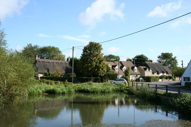
On a rain-swept morning in October, twelve walkers gather at the war memorial in Great Wishford, Wiltshire, clutching OS maps marked with dotted lines that most people never notice. These aren't footpaths or bridleways, but something far older and more mysterious — the ancient boundaries of their parish, invisible threads that have divided this corner of England for over a thousand years.
 Photo: Great Wishford, via static.cargurus.com
"Most folk don't even know where their parish ends," says Malcolm Wright, shouldering a walking stick worn smooth by decades of boundary walks. "But these lines shaped everything — where you worshipped, where you paid taxes, who you married, where you were buried. They're the DNA of community."
Today's walk will take eight hours and cover seventeen miles, following hedgerows that may date to Saxon times, crossing streams at bridges mentioned in Domesday Book, and pausing at boundary stones carved with initials that local children once learned by heart. It's a journey through invisible history — and part of a quiet revival that's spreading across rural Britain.
The Ancient Art of Knowing Your Place
Beating the bounds — the ceremonial walking of parish boundaries — was once as essential to community life as harvest festivals or church bells. Every few years, villagers would process around their territory, led by clergy and parish officials who would "beat" boundary markers with willow wands to fix them in collective memory.
The practice served practical purposes in an age before detailed maps or GPS coordinates. Boundary disputes could devastate farming communities, and collective memory was often the only reliable record of where one parish ended and another began. Young boys would be bumped against boundary stones or even dangled head-first into streams to ensure they'd remember crucial landmarks for life.
But beating the bounds was always more than legal necessity. These walks affirmed belonging, celebrated territory, and reinforced the bonds between people and place that made communities resilient.
"It was about knowing your patch," explains Dr Caroline Fletcher, who has researched boundary customs across northern England. "Not just knowing it intellectually, but knowing it with your feet, your muscles, your weather-beaten face. That kind of knowledge creates a different relationship with landscape."
GPS Meets Ancient Custom
The modern revival of boundary walking began quietly in the 1990s, driven by local historians and ramblers who noticed how parish boundaries often revealed hidden stories about landscape and settlement. But it's been transformed by technology that would amaze medieval boundary beaters — GPS devices that can locate historical markers to within metres, online archives that preserve centuries-old boundary descriptions, and mapping software that overlays ancient perimeters onto contemporary satellite images.
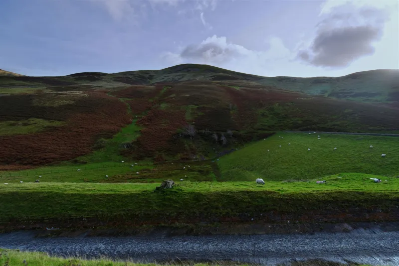
"We use all the modern tools," admits Sarah Blackwood, who leads boundary walks for the Malvern Hills Society. "But the fundamental experience remains the same. You're following in footsteps that go back centuries, seeing the landscape through the eyes of people who knew every field, every stream, every ancient tree."
 Photo: Malvern Hills, via wealthyspy.com
The combination of high-tech navigation and ancient routes creates fascinating juxtapositions. Walkers use smartphone apps to locate medieval boundary stones now hidden in suburban gardens. They follow GPS coordinates to find Saxon earthworks that modern farming has all but erased. And they discover that many 'new' housing developments are actually built within field patterns that parish boundaries have preserved for a thousand years.
Reading the Secret Landscape
To walk a parish boundary is to become a detective in the landscape's longest-running mystery. Why does this footpath suddenly veer left? Because it's following a property line established before the Norman Conquest. Why is there a gap in this hedge exactly here? Because medieval villagers needed access to common land that lay outside the parish. Why does this stream have three different names along its course? Because it forms the boundary between three separate communities, each with its own dialect and customs.
"Every boundary tells stories," says Tom Harrison, whose group has mapped the complete perimeter of six Cotswold parishes. "You learn to read the landscape like a book. This bank and ditch marks where medieval farmers divided arable from pasture. That line of oak trees follows a Roman road. Those field names on old maps — Priest's Close, Gallows Hill, Deadman's Acre — they're all clues to what happened here."
Boundary walkers become fluent in a landscape language that most people never learn to read. They notice how parish lines often follow natural features — ridgelines, river courses, ancient trackways — that made sense to communities shaped by foot travel and horse transport. They spot the places where boundaries make inexplicable detours to include a particular farm or exclude a piece of marginal land, preserving medieval disputes in the modern map.
Community in Motion
The social dimension of boundary walking proves as compelling as the historical detective work. These aren't solitary rambles but collective journeys that naturally generate conversation, shared discovery, and the kind of gentle camaraderie that comes from tackling mild hardship together.
"You get to know people differently when you're walking with them for eight hours," observes Janet Mills, who organizes boundary walks for three parishes in the Pennines. "The barriers come down. The farmer and the retired teacher find common ground. The teenager discovers the pensioner has fascinating stories. By the end, you've got a group that really understands what community means."
Many boundary walking groups have evolved into informal guardians of local heritage, documenting changes to historic landscapes, maintaining ancient rights of way, and lobbying for protection of significant sites. They've become advocates for the kind of deep local knowledge that helps communities navigate everything from planning applications to climate adaptation.
The Future of Ancient Lines
As Britain grapples with questions of identity, belonging, and community resilience, the revival of boundary walking offers something valuable — a way of understanding place that's both deeply rooted and thoroughly contemporary. These ancient lines through field and forest provide frameworks for thinking about local identity that transcend political boundaries and suburban sprawl.
"When you've walked your parish boundary, you see your place differently," reflects Malcolm Wright as Great Wishford's walking group completes another circuit. "You understand how the landscape shaped the community, how the community shaped the landscape. You realize you're part of something that goes back centuries and will hopefully continue for centuries more."
In an age of global connection and digital displacement, perhaps we need these invisible lines more than ever — not as barriers that divide, but as pathways that help us understand where we stand and why that matters. The ancient practice of beating the bounds is finding new life because it offers something essential: the chance to walk yourself into belonging, one careful step at a time.